GNSS Meteorology
GNSS technology is primarily used for navigation and precise geodetic positioning purposes, where for instance the atmospheric signal propagation is considered by sophisticated models. Although more and more complex models have been developed and applied in the processing software the accuracy of the atmospheric modeling is limited by the hardly describable time- and space-varying water vapor content of the troposphere. While in GNSS positioning the atmosphere is an accuracy limiting factor (noise), in meteorology the GNSS processing results are valuable and providing an independent estimate of the tropospheric signal delay and consequently the amount of water vapor in the atmosphere.

As a partner of the E_GVAP (EUMETNET EIG GNSS Water Vapour Programme) project the SGO GNSS Analysis Center routinely process GNSS data from 120 stations with Bernese 5.2 scientific processing software. The SGO1 solution is computed from January 2015 with high level of availability. The current status of proccessing can be found on E_GVAP website.
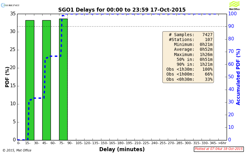
The distribution of the European stations participating in this E-GVAP program. The delay statistics of the SGO1 processing results availability. 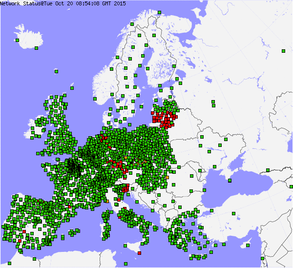
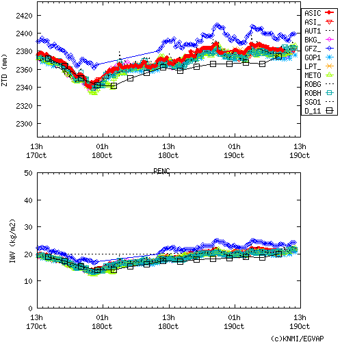
This near-real-time (NRT) processing is done each hour and the tropospheric delay estimates (ZTD – Zenith Total Delay) are forwarded to the UK Met Office, where they integrate all inputs coming from more than 2000 stations. The ZTD values are used to estimate Integrated Water Vapor (IWV) for each station. Participating meteorological services assimilate ZTD and IWV data to their models and numerical weather forecasting systems.