Satellite Radar Interferometry (InSAR)
The Interferometric Synthetic Aperture Radar (InSAR) is a state-of-the-art remote sensing technique able to measure and monitor displacements that opened unprecedented perspectives in geophysics, geology and geodesy. In its simplest form, InSAR combines two accurately aligned SAR images of the same scene into an “interferogram’ by computing the differences in the phase of the radar waves. This technique is able to retrieve surface movements and velocities with unprecedented resolution and precision. Its huge advantage is that no field survey markers are necessary, appropriate elements of the natural and constructed environment can also be used. Thanks to this capability and in contrast with any other deformation measurement technology, historic radar data, dated back to 1992 can also be involved into the studies decreasing the need for longer recent observation series.
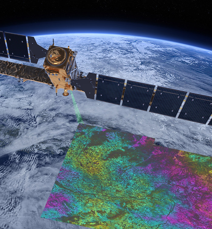
The primary data source of our InSAR investigations is the Sentinel-1 mission, which is part of the Sentinel Earth observation satellite series prepared and operated in the frame of the Copernicus program of the European Commission and the European Space Agency (ESA). The constellation with two satellites (Sentinel-1A and Sentinel 1-B) sharing the same orbital plane and a 180° orbital phasing difference, continues the C-band SAR Earth Observation heritage of ERS-1/2 and RADARSAT-1/2. At the same time it offers more favorable conditions in terms of practical applications for spatial coverage, return time, fast data transfer and reliability (Sentinel-1 User Handbook, 2013).
The Hungarian introduction of the InSAR technology and the preparations of its applications were initiated by the Satellite Geodetic Observatory in 2000. We built up the knowledge base, human resources were allocated and trained, and the IT infrastructure had been procured and installed. We use the professional GAMMA software, which provides all kinds of InSAR solutions and data products in an integrated way. We established, developing and maintaining an integrated reference marker infrastructure, the Sentinel Geodetic Base Network (SENGA), which collocates various geodetic technologies and reference networks.
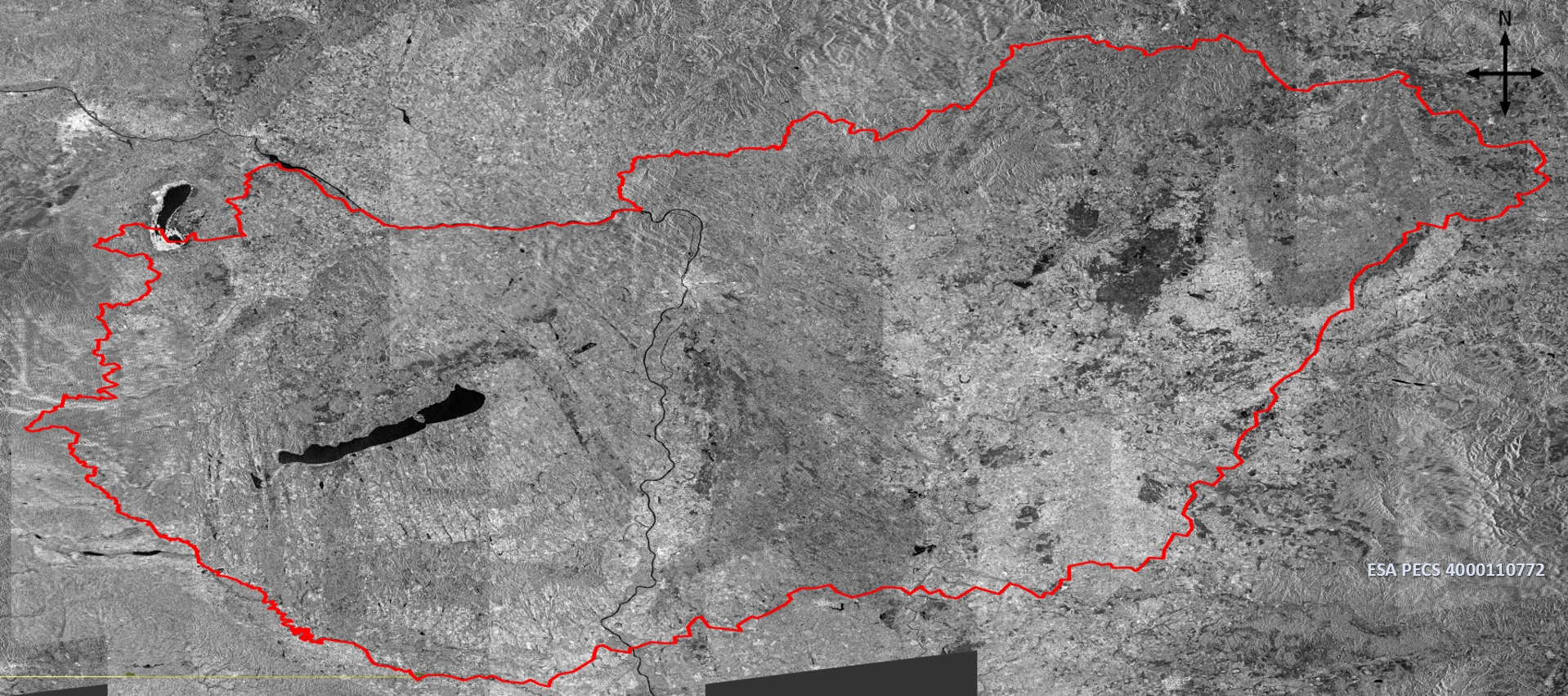
Mosaicked amplitude image of Hungary from descending Sentinel-1A SLC-s, after Renáta Hevér
Interferometric processing of the radar images can be grouped into Differential SAR Interferometry (DinSAR) which uses only two SAR images at different time epoch over the same area, and PS-InSAR, which stacks several differential interferograms for the long time-span or continuous phase analysis.
Differential Synthetic Aperture Radar Interferometry (DinSAR)
DInSAR technique is suitable for detecting surface change/deformation between two different acquisition time. In the processing we correspond the after event (slave) image into the reference (master) image geometry at sub-pixel accuracy to provide the best correlation between them. The relative phase difference between two points at two different time can be saved into an interferogram, which allows to analyse surface deformation and displacements in the order of a fraction of the wavelength. Using this procedure large spatial coverage surface motions can be determined in places, where in situ measurements are not feasible due to the nature of the event like earthquakes or landslides. The usage of the DInSAR technique is very wide ranging from individual case studies to PS-InSAR integration. As an interpretation we present two of our case studies:
left) Differential Interferogram of the South-Taiwan earthquake (5th February 2016. with a moment magnitude of 6.4). (right) Line-of-sight displacement of the same earthquake. 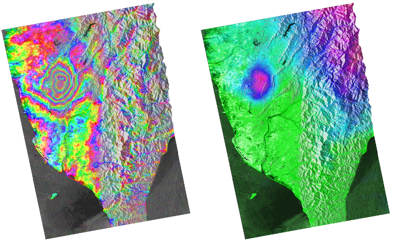
Persistent Scatter Interferometry (PS-InSAR)
Persistent Scatter Interferometry analyses the phase change of the signal back-scattered from stable reflecting points, which are present on all studied images over long time (usually using at least 25 images). Persistent scatterer (PS) InSAR overcomes the decorrelation problem by identifying resolution elements whose echo is dominated by a single scatterer in a series of interferograms. Thus the coherence loss due to time difference can be reduced and the atmospheric effects can be removed by iteration. In this point of view PS-InSAR plays an important role in the extending the scope of the available data. On the one hand, there is a possibility for a larger period of time (years or decades) for conducting comprehensive phase histories. On the other hand interferometric pairs with longer baseline can also be involved into the processing. Persistent scatterers with continuous and stable reflection are usually man-made structures (buildings, metallic objects) that can be used to determine the displacement (in the satellite line-of sight direction) with an unprecedented resolution (up to 500-1000 points/km2) and at high precision (0.1-0.2 mm/year). There is no need for in-situ measurements and geodetic marker installation, so the technology can be effectively applied in areas (cities, built-in areas) where the capabilities of other methods are limited. Unfortunately rural areas (forest or agricultural cultivation) are less useful because of the limited availabilty of permanent scatteres, although some artificial objects or special scattering objects designed and implemented for this purpose allows the investigation of such territories.
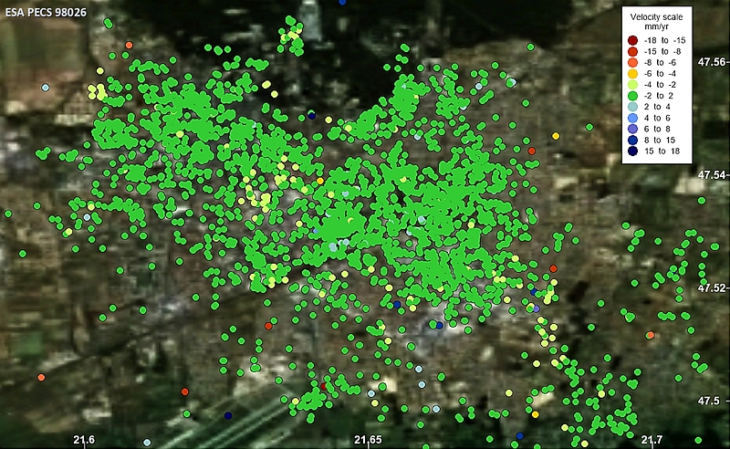
Integration of InSAR measurements into geodetic systems, Sentinel Geodetic Reference Network (SENGA)
Supported by ESA PECS, the Sentinel Geodetic Reference Network (SENGA) had been established for the geodetic integration of InSAR technology. At selected MGGA (Hungarian GPS Geokinematic Reference Network) special corner reflectors were installed. With GPS and leveling measurements we realized the indirect InSAR collocation of SENGA with MGGA, the permanent GNSS network (GNSSnet.hu) and the Hungarian Unified Leveling Network (EOMA). This has created the ability to determine and monitor the 3D coordinates and velocities in a common geodetic reference frame. The network is currently includes eight corner reflectors, which will be extended from 2019.
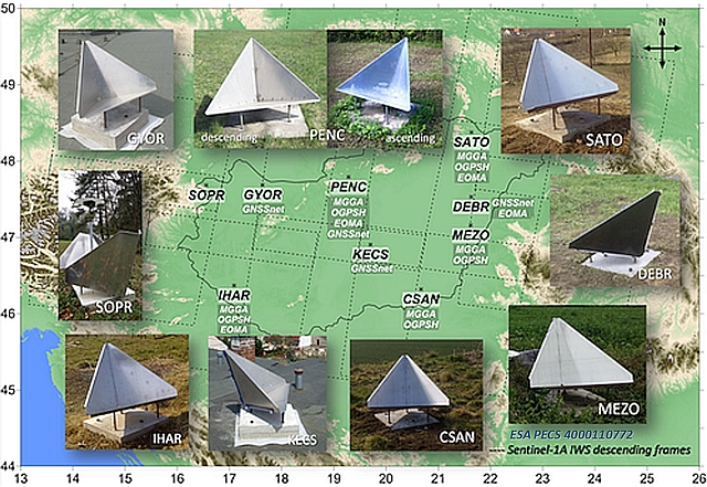
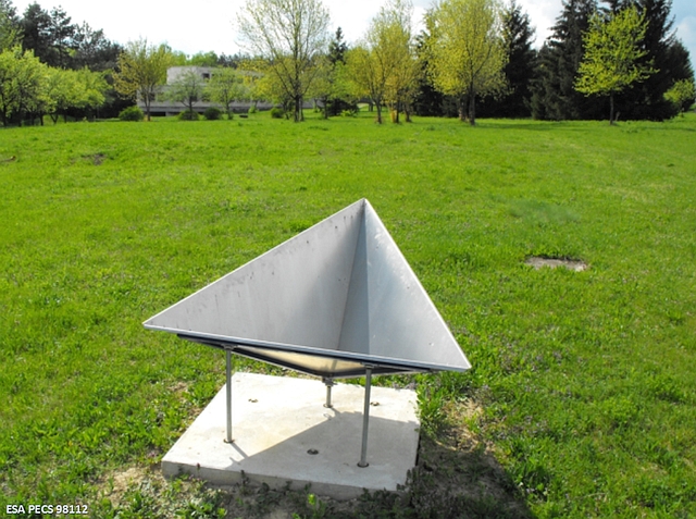
The corner reflectors of the Sentinel Geodetic Network
Physical structure of the Sentinel Geodetic Reference Network (SENGA)
The corner reflectors are passive markers, which efficiently reflect the satellite radar signal and they can be easily identified and monitored on the radar images. The SENGA network is composed of trihedral rectangular reflectors whose technical details (coordinates, inner leg length, azimuth and height) are available in the point descriptions.
The SENGA point with corner reflector in the SGO’s park.